
DID you know that The Queen owns a stretch of river estuary which passes through Warrington and Halton?
In fact, The Crown Estate controls about 45 per cent of England's foreshore.
As the Queen’s Platinum Jubilee approaches and the country celebrates all things Royal, we took a look at the Crown Estate Foreshore and Estuary Map to find out exactly which in our area are controlled by the Monarch.
The section of the River Mersey estuary owned by Her Majesty includes that in between the Silver Jubilee and Mersey Gateway bridges.
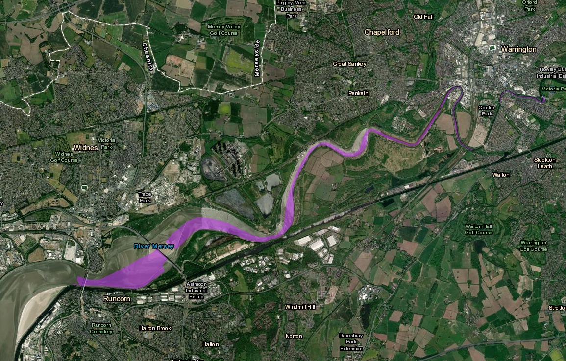
The areas in purple are under the control of the Crown (Image: Crown Estate Foreshore and Estuary Map)
Her ownership continues past Penketh and Sankey Bridges to Bank Quay, around Centre Park and up to Howley Weir near Victoria Park.
The parts not under the control of the Crown are owned or leased by organisations including the National Trust, local councils, Ministry of Defence and private individuals.
The ownership of oil and gas on land and at sea rests with the Crown, but since 1934 the job of exploiting it by setting royalties and assigning drilling rights has rested with the Government.
However, the Crown Estate can generate money from leasing out foreshore to wind turbine firms and in 2021 it held its first auction of seabed plots for windfarm turbines in a decade.


Comments: Our rules
We want our comments to be a lively and valuable part of our community - a place where readers can debate and engage with the most important local issues. The ability to comment on our stories is a privilege, not a right, however, and that privilege may be withdrawn if it is abused or misused.
Please report any comments that break our rules.
Read the rules here